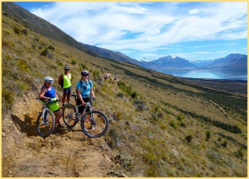
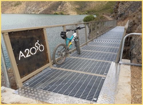
 The Alps 2 Ocean Cycle Trail, (A2O), is New Zealand's longest cycle trail stretching over 300kms and delivering epic vistas as you ride from the foot of Aoraki Mount Cook all the way to the Pacific Ocean. The trail is one of New Zealand’s Great Rides, (there are 23), marketed as Nga Haerenga, or the New Zealand Cycle Trail. Officially opened in 2013, it is regarded as the crème de la crème of multi-day cycling experiences in New Zealand set amongst the highest mountains in Aotearoa, the iconic South Island high country and the coastal landscapes of North Otago.
The trail as you see it today is the result of 14 years of development since the idea was first initiated. It is now 10 years since the first extensive section of the trail was officially opened in 2013 and time to celebrate and reflect on the success of this internationally renowned and highly rated cycle trail.
The story of the Alps 2 Ocean Cycle Trail began post the Global Financial Crisis in late February 2009 when the then Prime Minister, John Key announced that a cycleway from Cape Reinga to Bluff was one of the suggestions from a government think tank. This was followed by the idea to create a series of regional trails and the national cycleway project.
The idea of a national cycle trail in the Mackenzie began with a phone call between Denis Callesen (who was a board member on the Mackenzie Tourism and Development Trust, (MTDT), and Phil Brownie (who was employed by the MTDT), a day after this announcement. This resulted in a meeting over several bottles of red wine at The Hermitage and the concept of developing a trail in the Mackenzie as part of the government initiative began to take shape. Mike Barnett, a tourism consultant from Queenstown was involved with these early discussions. Phil also discussed the concept with Lesley Roy, (Chair of MTDT) and Council members along with Department of Conservation, (DOC), and several tourism operators.
Meanwhile, Rick Ramsay, a Twizel resident had been spending his time driving up and down the Waitaki Valley from his home thinking about cycle trails and was developing an idea based around a trail down the Waitaki Valley. While developing this idea with Glenn Ormsby from Tourism Waitaki, he was approached by Phil Brownie to chair the inaugural meeting. Rick wrote a summary of his thoughts which was circulated and with the plans that Denis, Phil and Mike Barnett had been working on for the previous two months the concept of a full “Alps to the Sea” trail started to develop.
In May 2009 a 3-year national cycle way project with a budget of $50M was announced by the Government and bids for this fund were requested. Over the next few months, the “Alps 2 Ocean” concept was developed based on a 300km trail from Aoraki Mt Cook to Oamaru.
In June 2009, an inaugural meeting chaired by Rick between both groups of people from the Waitaki and Mackenzie to discuss the concept of the cycle trail. Those in attendance were Rick Ramsay (acting chairman Twizel), Stephen Jay (Meridian Energy Twizel), Ian (Gus) Guthrie, (DOC Twizel), Phil Brownie, (Mackenzie Tourism Board); Denis Calleson, (Member Mackenzie Tourism Board); Peter Bell, (Twizel Community Board); Jane Matchett, (Waitaki District Council ); Glenn Ormsby, (Waitaki Tourism and Development Board); Marcus Brown, (former property manager Waitaki District Council, cycle business operator); Craig Dawson, (chairman Ahuriri Community Board), and Mike Barnett, (Barnett and Associates, Queenstown). Coralie Reid provided the secretarial services to the group.
This was really the formal and official start of the “Mackenzie Basin to the Sea” Cycle Trail as it was initially called at this meeting and the setting up of a coordinating group initially called the Steering Committee.
Over the next few months, the concept was developed and the route was fine-tuned with ideas like Jane Matchetts’, of taking it via Lake Ohau Lodge, which proved to be a master stroke as far as routing the trail to Omarama from Lake Ohau. It was also important in terms of bringing Lake Ohau Lodge and accommodation businesses at Lake Ohau Village into the picture and fulfilling the economic development goals of the trail. By August it was officially being called the Alps to Ocean Cycle Trail.
After the second meeting of the group, Rick advised he was unable to continue as the permanent chair due to his other commitments. Rick rang Mike Neilson, (who as a Waitaki Tourism Board member and local from Oamaru was seen as an excellent replacement), to ask him to undertake the role. But before he managed to put the question, Mike at great length proceeded to tell him what a fantastic idea it was and how important it would be for the local economy and Lake Ohau Lodge. Only, after this did Rick manage to say, “well you wouldn’t mind being the chair of the Steering Group then?” End of story!
By October 2009, the Waitaki and Mackenzie District Councils along with Mackenzie Tourism and Development Trust, (MTDT), and Waitaki Development Board, (WDB), had joined forces to create the “A2O Governance Group”, to manage the trail concept and implementation. This group of people represented various agencies and interested parties from the wider area. The Governance Group members were Michael Ross, Glen Innes, Thunes Cloete, Phil Brownie, Annabel Berry, Rob Young, Denis Callesen, and Mike Neilson, (representing the two Councils, MTDT, WDB, DOC, The Hermitage and WDB).
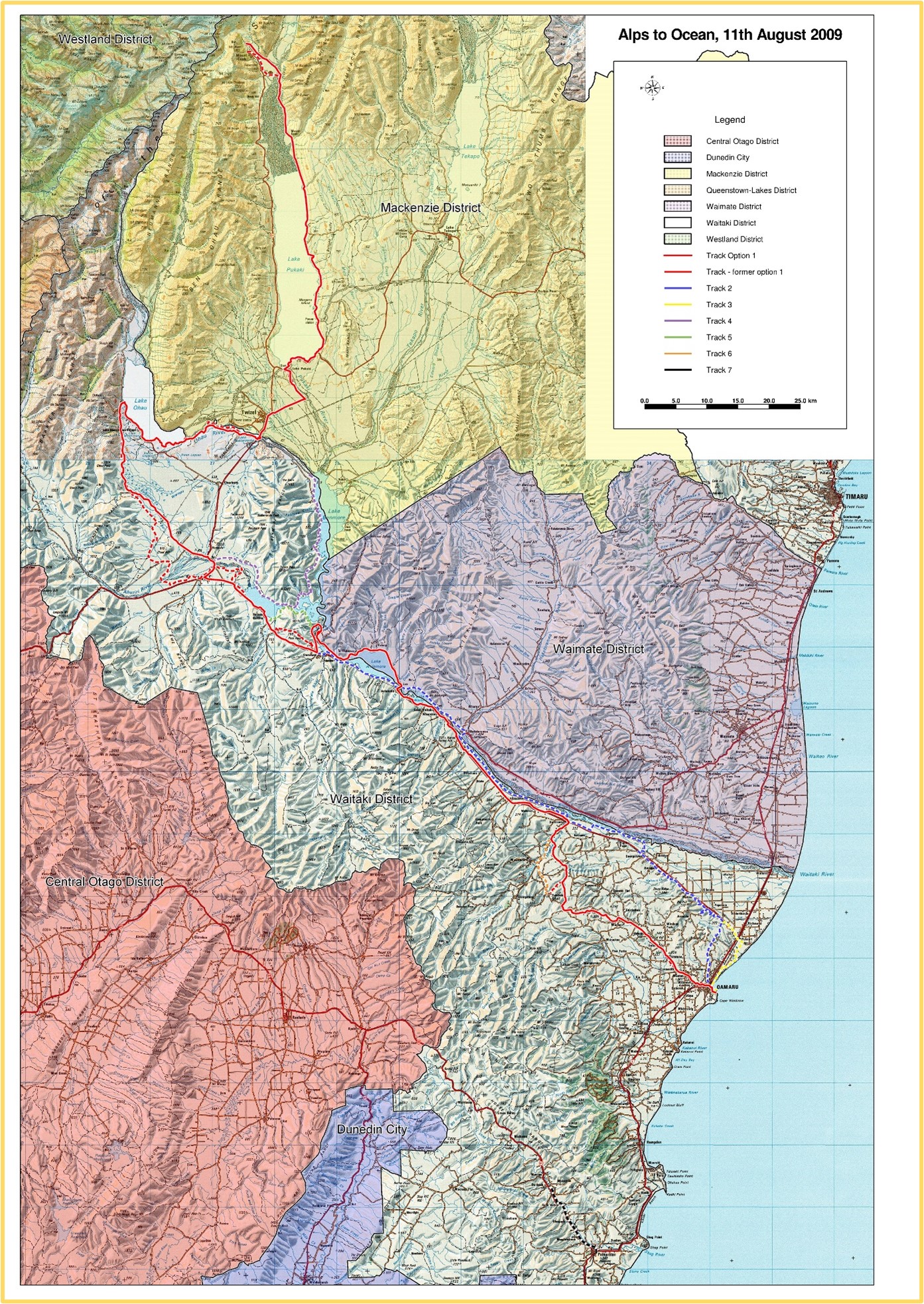
Figure 1: The first map of the proposed Alps to Ocean Cycle Trail which the built trail largely follows.
After presenting a concept plan in December 2009, approval for the development of a Feasibility Study was granted along with $100,000 grant from Ministry of Economic Development, (MED), in February 2010. This Feasibility Study was completed by May 2010 and soon after in order to be “first out of the blocks”, without building anything, the first 1.3km section of the trail was opened from the historic precinct to the Penguin Colony, by the Prime Minister, John Key.
In September 2010 a contract was signed between the two Councils and the MTDT, (the Joint Committee”), and MED for a grant of $2.75M to build 301 km trail from Aoraki to Oamaru by September 2011 along with community funding of $650,000. A Project Team was set up and in December 2010, Chris Eden was appointed as the first Project Manager.
The Governance Group, eventually became the legal entity known as the “Joint Committee”, with representation from WDC, MDC, WDB, MTDT, DOC and a cycle industry representative.
Sitting underneath this Governance Group, was the Project Team, which was tasked with planning, negotiating, and building the trail to the desired standard. It managed the funding, planning and building of nearly two thirds of the trail, (195km), between 2010 and 2020. The team had representation from the tourism industry, concessionaires, Department of Conservation, Mackenzie and Waitaki District Councils and Tourism Waitaki as the operator of the built trail. The Project Team became the driving force of the fund, plan and build phase for the next 10 years meeting every month or bi monthly.
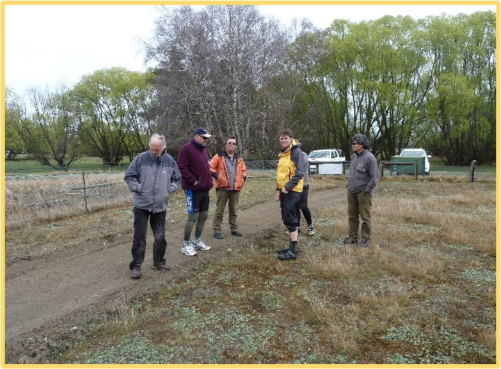
| Members of the early Project Team inspect the finished product of the rockcrushing on the Pukaki Flats. L-R; Chris Eden, Denis Callesen, Iain Guthrie, Jonathan Kennett, Rob Young. |
The long-term plan of the A2O since its genesis in 2009 was to get the trail largely off road and have it start at Aoraki / Mount Cook and finish at the Pacific Ocean. The project started by providing linkages between on road sections and taking off road the critical major State Highway sections to create a much safer trail and one that would be rated highly by users.
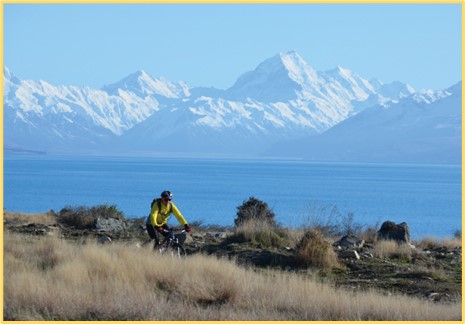
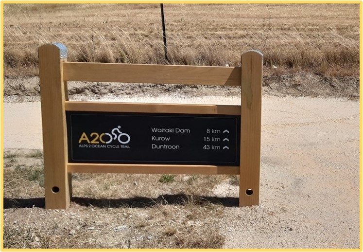
The first part of the trail to be planned and constructed was the 8km section along the south shore of Lake Pukaki.
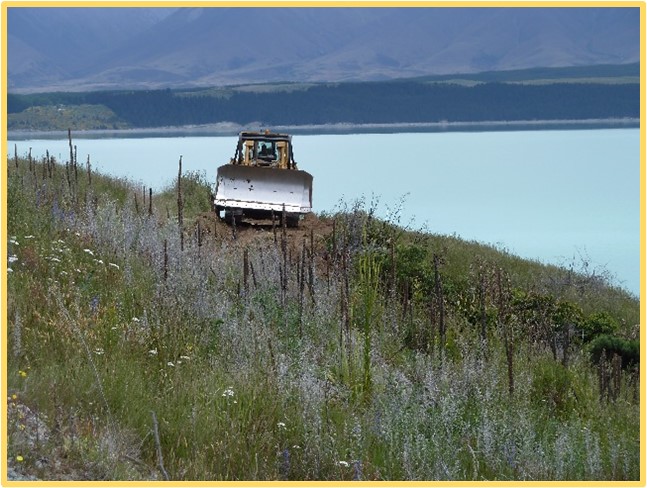 | Wilsons Contracting in action on the first section of the A2O to be constructed on the south shore of Lake Pukaki – December 2011. |
It was decided to do this to a very high standard given its visibility and potential popularity as a local ride. Completing it to a high standard also involved treating the gravel surface with a binding compound resulting in a sealed like surface, which unfortunately proved to not be enduring. This section, (pictured below), with spectacular views of Aoraki / Mount Cook was completed and opened to the public in late December 2011.
 At the same time important aspects like creating a brand, a consistent sign design, protecting the trails intellectual property and initiating a concession application to DOC, so that key parts of the trail could be constructed as soon as possible were underway.
The development of the brand and sign design was done professionally by Kiriana Glasson of Glue Creative, who cleverly concocted the combination of the Nga Haerenga brand and the distinctive A2O symbol and the colour palette representing the landscape that the trail takes each rider through.
Between 2011 and early 2013 all the Stage 1 sections of the trail were completed including Aoraki Village - White Horse Hill - Mount Cook Airport, Tasman Point – Jollie River, Lake Pukaki – Twizel, (across the Pukaki Flats), southern Lake Ohau section, and finally the Ohau Lodge – Quailburn. Largely these sections were either on public conservation land or Crown Land so the negotiating for access was relatively simple.
 | The branding and colour palette reflecting the landscape and its use in the signs along the length of the trail has both ensured the branding stays consistent and made it easy to follow the trail. |
The building of the section from Aoraki / Mount Cook Village – Airport was driven by Richard McNamara who at the time was the Area Manager with DoC. This section was completely funded by DoC.
The next section from Tasman Point to the Jollie was the first section where the use of the rockcrusher machine was used to establish a trail and smooth the surface of the existing 4WD track.
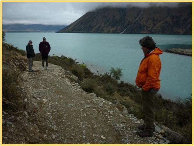
The 8km section around Lake Ohau from the weir, was initially started with funding from DoC too, in spring 2011. This section was built on an old surveyed marginal strip which was fortunately 40m wide. It enabled this whole section to be built without crossing private land, which meant it could be constructed relatively quickly after gaining the resource consent. Like many sections of the A2O there were many concerns about the impact on landscape and biodiversity values.
 | Project Team inspect the start of work on the Lake Ohau section, October 2011, L-R; Chris Eden, Denis Callesen, Rob Young. |
The section across the Pukaki Flats was another section where the surface was created with the rockcrusher. While it was initially successful in the dry season, when winter came the surface became very muddy and soft and later had to be surfaced with gravel.
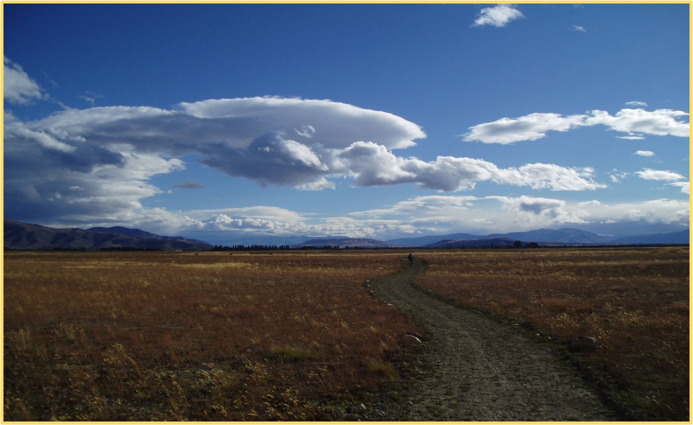
The route for this trail was designed by Gus Guthrie and was labelled the “zen” trail by Denis Callesen because of the feeling of being in the centre of the Mackenzie Basin surrounded by wide open spaces, big sky’s and tussock grasslands, (photo above).
In February 2012, a Wanaka company, Southern Land along with the current project manager Hamish Seaton became the new team for driving the project forward. Hamish was a highly regarded cycle trail designer from Dunedin who worked alongside Southern Land, led by Tim Denis. It was their skills and experience which meant the construction of last two trail sections of Stage 1, (Lake Ohau and Tarnbrae), and the later sections down the Waitaki were successfully completed.
This stage included debates amongst the Project Team about the trail route from Mount Cook Village to Twizel. A route all the way down the western side of Lake Pukaki was investigated before finally settling on the eastern side route. This had to involve a crossing of the Tasman River. Options looked at for this crossing included a bridge, jet boat, (including trialing it with two jet boats – with Mike and Jock Neilson and Craig Ovenden), and helicopter. The bridge design was developed by an engineering friend of Denis Callesen but in reality this part of the braided Tasman River is not easily bridged. Despite finally settling on the helicopter as the best option this crossing still creates debate today amongst those using the trail today, but for many it is their first helicopter ride and one of the highlights of the ride.
Waitaki Tourism was contracted in 2012 to provide business and marketing services and overseeing the maintenance programme for the trail. This included the fulltime Marketing and Sales Officer based in Twizel, Jason Menard, and other staff in Oamaru. Tourism Waitaki undertook trade promotions, marketing, established a website, produced the trails first brochure, and further developed the partnership programme with businesses involved in the trail. A one stop online booking system was set up for the convenience of cyclists and with the intention of raising finance to fund trail activities. In the end the booking system was too complex and proved unsuccessful. A range of merchandise including stickers, T-shirts, caps, and water bottles was also successfully developed. Their role also included event management.
 Rob Miller continued the work of marketing and promoting the trail through 2018 – 2021, after Jason Menard left. However, marketing up until 2017 had been so successful that there was a risk of over selling the trail experience and putting the trail experience at risk until more off road sections were opened, so this marketing was toned down to alleviate this issue.
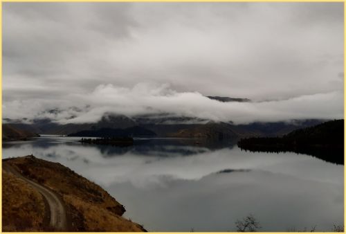
 | Lake Ohau, one of five lakes the trail passes on its passage to the Pacific Ocean from Aoraki / Mount Cook. One of the highlights of the first section constructed in between 2010 and 2013. |
 | A couple of weeks before the official opening these intrepid cyclists rode the Tarnbrae section of the trail and were helped across the final 100m unbenched section by the digger operator. |
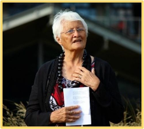 | Anne Te Maiharoa – Dodds blessing the trail at the opening function at Aoraki Mount Cook in February 2013. |
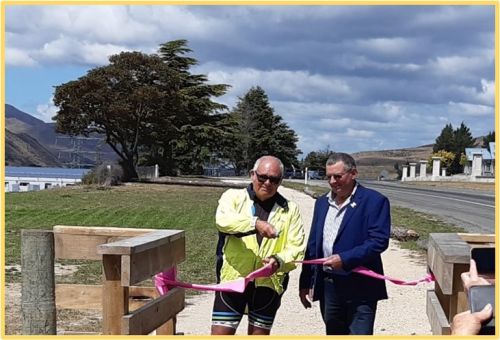
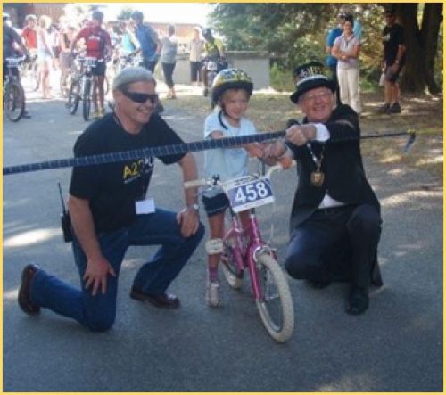 | Chair of the Joint Committee, Mike Neilson and Mayor, Alex Familton with the youngest rider cutting the ribbon to open the Lake Ohau to Omarama section on 17 February 2013. |
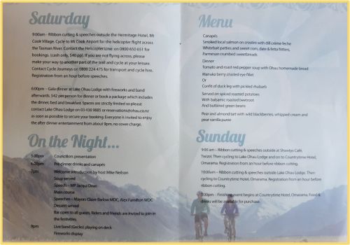 | The 2013 A2O Opening Programme, spread over 2 days, which featured rides of sections of the trail, a celebratory dinner at Ohau Lodge and speeches from MP Jacqui Dean and Mayors, Alex Familton and Claire Barlow. |
In February 2013, just over 2 years after starting construction, Stage 1 consisting of four sections and about 68kms of the built trail from Aoraki/Mt Cook to Omarama was opened with celebrations over two days at Aoraki /Mount Cook, Lake Ohau Lodge and Omarama.
Funding for the Stage 1 sections came from the initial MED grant, ($2.75M), along with other significant contributions totaling $650,000 and a contribution of $420,000 from the Department of Conservation.
In the first year of its existence there was strong support through the partnership programme with 117 official partners and 32 gold partners who paid a fee to belong to the programme. A regular newsletter was provided to nearly 7,000 subscribers. This support continued to grow as the cycle trail became more widely known and popular resulting in social media channels showing strong support for the trail both from visitors and locals. The annual one-day A2O Summit which brought all those with an interest in the trail together once a year was also an important part of informing stakeholders and building and maintaining support for the trail.
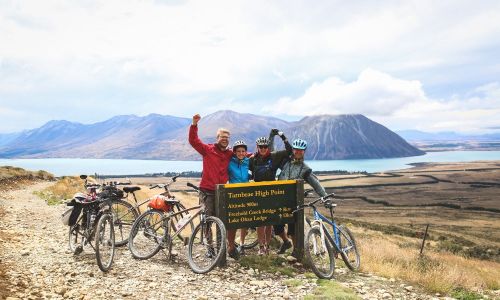
| The Tarnbrae Summit – the highest point on the trail, part of the trail opened in 2013 between Lake Ohau and Quailburn. |
The instant success of the trail was due to several factors including its outstanding scenery and variety of landscapes, community support, a well lead and driven Project Team, the high standard of the built trail and the marketing skills of Jason Menard. Without all these ingredients along with the leadership from the Joint Committee and the Councils especially the Waitaki Mayor, Alex Familton and Waitaki CEO, Michael Ross, it would not be where it is today. This combined with several companies who were keen to both provide guiding and cycle services to this new trail immediately meant it started on the front pedal. Geoff Gabites, Director of Cycle Journeys, a keen supporter of the trail from the start says, “Because we had experience with trips on the Otago Central Rail Trail, we had an insight into what could be possible with what was a longer trail and with that a huge diversity in landscape. Operators quickly lined up to offer services and 10 years on, the trail has stimulated many new trail offerings and bringing significant economic benefit to the many trail communities.”
A Business Plan was produced in 2013 which outlined how the trail would be completed and a model for funding the ongoing maintenance and marketing. The Department of Conservation granted a concession to build and maintain the trail on public conservation land and which also enabled the A2O to collect the concession revenue from commercial operators for the benefit of the trail and its maintenance.
| The first brochure masterminded by Jason Menard the Sales and Marketing Officer, from 2012- 2017. The brochure was a very popular product with cyclists.
The brochure is still produced in this format and is now in its sixth edition with many features including section descriptions, detailed safety information and FAQs.
The brochure and website along with marketing and the social media campaign provided significant exposure for the new trail and was a key reason for its significant growth in the first few years.
Attendance at TRENZ, (Tourism Rendezvous New Zealand), and marketing trips to Australia were also a key part of building exposure for the trail. |
The first cycle counters were installed in 2013 at Lake Pukaki, Lake Ohau Weir and on the Lake Ohau Lodge – Tarnbrae section. The simple total for the 2014 year from these 3 counters was 19,463. A weighted count of the three counters intending to measure the number of individual cyclist visitors was 11,804. Data from these counters have been an important part of gaining information for trail development and funding bids along with formal surveys1 and casual online surveys of cyclists after riding the trail.
[1] Alps 2 Ocean Cycle Trail Visitor Survey 2020, Mkwara. L. et al., Lincoln University
| A “Friends of the Alps 2 Ocean” was established as a fund-raising group, led by Adair Craik in 2012 and enabled the A2O to make several applications to several community trusts, organisations like Meridian and Lotteries. They also launched a public fund-raising programme. Adair and Annabel Berry are pictured with one of the advertising hoardings erected along the trail. In total nearly $1.3M was facilitated by this group which enabled the completion of the funding for several of the Stage 2 and 3 sections. |
A Visitor Risk Management Plan commissioned in 2013 became an important tool in planning and leveraging more funding for Stage 2 and 3, which involved off roading the high-risk 100kmh sections of SH83 and the sections between Duntroon and Oamaru. As a result of this plan further safety improvements were made to the trail like safety barriers. It also became the key ingredient in developing the safety messages in the brochure and on the website and making safety an important part of the process of commissioning new built sections. Some of those messages may seem obvious like the Tasman River should not be crossed on foot – but it has been tried on several occasions, with one person spending a very cold, wet night out, fortunately without tragedy.
Enroute communities were already seeing the economic benefit from the tourism created by the trail by 2014, even though the whole off-road trail was not complete. Towns such as Twizel and Omarama had already derived benefit from the trail users through several business streams including accommodation, food, bike operators, and bike repair and parts sales.
Mike Neilson at Lake Ohau Lodge commented after the 2013 cycling season that, “they had 1,384 A2O guest nights at the Lake Ohau Lodge”. Often on the trips with Mike to the Project Team meetings in Otemetata when traveling together he would spy some cyclists riding the trail and he would quip, “see those people they just turn up at the Lodge and spend money – I don’t have to do anything to get them there, no advertising, nothing!” This anecdotal evidence shows that the model of cycle trails providing real regional economic benefit works.
In the second full year of operation based on guest nights the Alps 2 Ocean Cycle Trail had produced economic activity results well ahead of the business plan produced in February 2013. For the year ending June 2015 the cycle trail guest nights had increased by about 40% over 2014 to around 7,800 and nearly double the estimate provided in the second year of the business plan. The direct expenditure by the cycling tourist in the A2O districts was estimated to be about $5m and based on the proportion of accommodation and other official partners south of the Waitaki River, over $3m in the Waitaki District.
Construction of Stage 2 of the trail to off-road the SH83 sections was split into five projects, which were built over an extended period of seven years from 2013. While a significant proportion of the funding for these sections was provided by Ministry of Business Innovation and Employment, (MBIE), the total of grants from Trust Aoraki, Otago Community Trust, Friends of A2O, Meridian Energy, Whitestone Construction Ltd and Waka Kotahi exceeded $900,0002.
[2] See “FUNDERS OF THE TRAIL”
The first part of Stage 2 to be constructed was the 13km Omarama – Sailors Cutting section, which was completed in 2014. Despite building a high standard of trail beside SH83 some cyclists still insisted on riding the tarseal road, (smoother and easier they claimed!), which continued to compromise cyclist safety. Soon after, the short 6km section from Otemetata to Loch Laird was completed. Initially this connection took cyclists on an off-road route to the Benmore Dam from Otemetata to encourage cyclists to use the quiet road around the back of Lake Aviemore, rather than head straight down SH83 to Kurow. With the completion of the Ahuriri Arm section, it is now a side route to Otemetata, but in the long term will be part of the main trail down the Waitaki.
The MBIE funding included three other sections of the SH83 off-road project. The first of these was the 28km section from Kurow which wound through the winery and down alongside the Waitaki River, past the Tokarahi rock art and finally into Duntroon. This section was completed in May 2017.
| Taking the trail off SH83 was a focus of the second stage of the build. While it often had to be built adjacent to the highway it made this part of the trail much safer and pleasurable to ride. |
The next part to be completed in January 2018 was the 6km from the Awakino River to Kurow (part of the Aviemore to Kurow section). This section was a high priority because it meant cyclists could avoid the narrow and winding high risk section of SH83 just before Kurow by riding up onto the terrace well above the road. Development of this section followed lengthy investigations of alternative routes for this part of the trail from Aviemore including down the north side of the Waitaki. The remaining 10km of this section from Aviemore to Waitaki Village, which for part winds around the edge of Lake Waitaki was opened in February 2020.
| Waitaki District Councillor, Mike McRobie and Mackenzie District Mayor, Graham Smith cutting the ribbon for the Aviemore to Waitaki Village section of the trail in February 2020. |
The last section of the SH83 trail with its “bluff” bridge between Sailors Cutting and the Benmore Dam was completed in December 2020, after protracted negotiations over the proposed route through the Ahuriri Gorge and finalizing the funding with MBIE. The final result, a combination of a route on private land and marginal strip has resulted in one of the most spectacular and exciting rides on the trail.
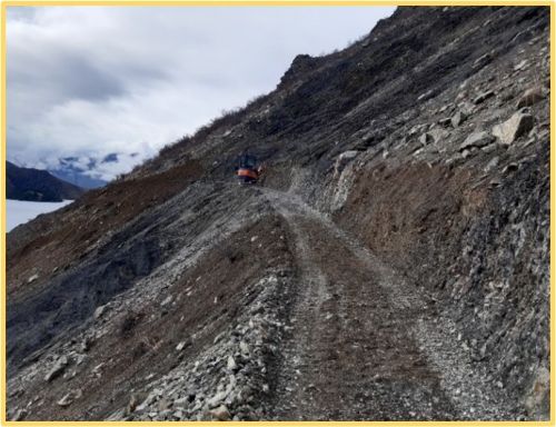
| Excavating the benched trail across the steep slopes above Lake Benmore on the Sailors Cutting to Benmore section of the trail. |
While there was lots of construction going on above Omarama in the early part of the A2O there was also 30kms of trail between Duntroon and Oamaru being constructed which meant that about half of this section was off road by 2015.
| The Sailors Cutting to Benmore section is one of the most scenic parts of the ride. |
To complete a further 21km of this part of the trail in August 2015 a Lottery application for, four Oamaru to Duntroon sections was lodged. This application was successful in gaining $629,000 which along with funding from the Otago Community Trust of $484,000 and a grant from the Waitaki District Council of $350,000 meant this other half of the trail through the Waiareka Valley to Oamaru was constructed between 2016 to 2018.
| Orientation panels on the Sailors Cutting to Benmore section are envisioned to be a feature of each section start and finish. |
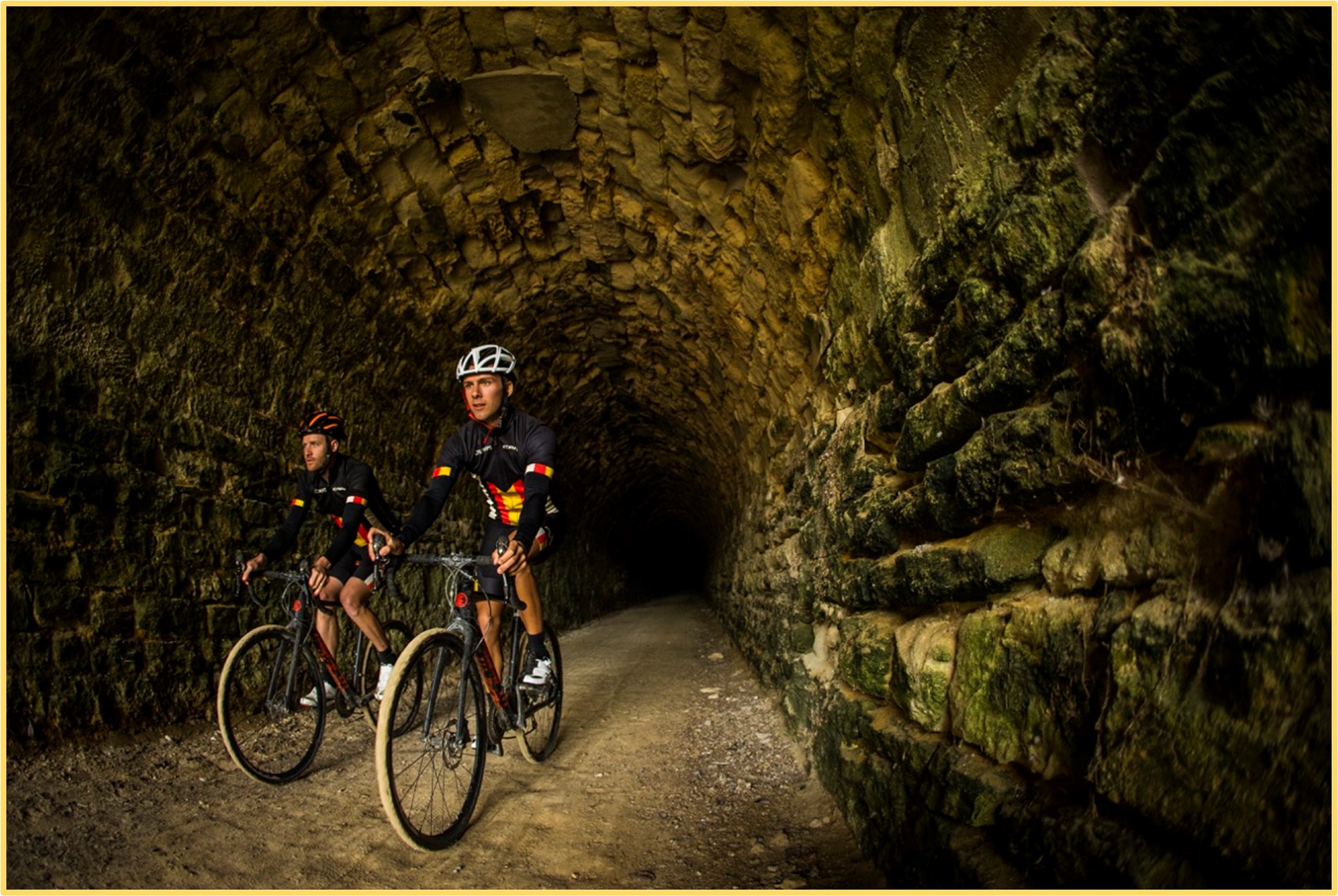
Completion of this section of the trail made it much more pleasurable and safer to ride either as a day ride or as part of the complete A2O ride. This resulted in increased economic gains for the local communities especially at Duntroon and Oamaru as start and finish points of this section, as well as accommodation along the way including Burnside Homestead, Gods Old House, Windsor and Tokarahi Homestead. A significant feature of this section is the Victorian era railway tunnel which involved long discussions with Heritage New Zealand and reengineering and drainage to make it safe. Its twin tunnel on this section awaits development of the final off-road section between Duntroon and Oamaru in the future.
| The A2O branded “bluff” bridge on the Sailors Cutting to Benmore section of the ride. This section provides some of the most spectacular riding and scenery on the trail and many opportunities for photo stops and rests. |
The complexity of planning and negotiating much of the off-road trail from Duntroon to Oamaru meant that this section took a lot longer than the first sections built north of Omarama which in many cases only involved one or two landowners. For instance, this section involved obtaining easements from 14 landholders across private land. While the process of negotiating these agreements took some time in many cases the route has involved significant compromise from landholders which they agreed to for the greater community good.
 By late 2020, with the completion of the Stage 2 (bypassing SH83) and Stage 3, (Duntroon – Oamaru), the trail was all off road from Omarama to Oamaru other than the 25 km section on the low volume secondary road (Te Akatarawa Rd) around the north-east side of Lake Aviemore. Official openings were held for the 16km Aviemore to Waitaki Village section on the 8 February 2020 and the Sailors Cutting to Benmore Dam section on the 18 December 2020.
From the beginning contractors have been a vital part of both construction and maintenance. Wilson Contractors from Queenstown were the first and constructed many of the Stage 1 sections while more recently M3 Contracting from Timaru have been the principal trail construction contractor. Andrew Bailey, Director of M3 brings his mountainbiking background to the construction of the trail and his specialized trail building machinery which has ensured an excellent standard of trail for cyclists. Construction of many of the bridges, safety fences and boardwalks were completed by Clint O’Brien of Recreation Construction, including the “bluff’ bridge and the clip-on at Awahokomo River at SH83.
| The clip on being constructed on the Awahokomo Bridge. This was not completed until 2021 due to planning and design requirements that were required by Waka Kotahi. |
By now the economic gains and growth of this trail were following a similar pattern to that of the Central Otago Rail Trail3.
[3] Refer to “The Otago Central Rail Trail Economic Impact and Trends Survey 2008”.
The other vital key to the trail’s success was the willingness of landowners and land managers to allow the trail to be routed through their properties and on public land. In total 25 private landowners or companies have given access for the trail to constructed over their land. This contribution has allowed the wider community to benefit from the trails economic and health benefits and is widely appreciated by everyone who rides the trail and the trail owners and managers. In addition, the Department of Conservation, Land Information NZ and both Councils have allowed the trail to be constructed over a significant portion of the route.
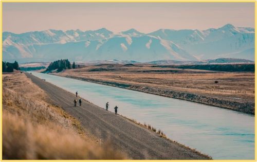 | The alternate start at Lake Takapō was officially included in the trail in 2016. The closure of the Takapō -Pukaki canal by Genesis Energy meant that cyclists had this section of the ride to themselves. |
While the long-term planning and risk analysis had highlighted other sections of the trail which needed to be made safer and more pleasurable including East Pukaki and the Quailburn Road, progress on funding these sections have meant they remain as on road sections. The alternate start from Lake Takapō to Twizel became popular because of the state of the East Pukaki section and was officially signed and included as part of the trail in 2015.
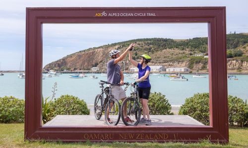 | One of the popular additions to the trail was this photo frame at the finish in Oamaru opposite the popular thirst-quenching Scotts Brewery. It has featured in many group photos since it was installed in 2018. |
As the trail has developed, third parties have published information like the “Alps 2 Ocean Easy Guide” by Brian and Diane Miller and the Great Rides App. Both these tools with their graphics and trail guide notes help cyclists with the planning and on trail decision making.
The advent of E-bikes has brought the trail withing the reach of a whole new cohort of cyclists and this part of the market will no doubt continue to grow.
The trail has received much media attention and was listed in Lonely Planet's “Epic Bike Rides of the World” as well as being highly rated in several New Zealand and international travel publications. Plaudits have continued over the last 10 years4. One of the highlights of these plaudits was at the 2016 ASB Otago Sports Awards, when the Alps 2 Ocean Cycle Trail was the recipient of the University of Otago “Innovation in Sport Award”. Thunes Cloete, Project Team Chair and Community Services Group Manager, Waitaki District Council at the time said on receiving this award, “This project, from its inception, has been planned and implemented over time by different people who have worked hard to bring it to fruition. They are to be congratulated with a job well done.”
[4] See “AWARDS AND ACCOLADES”.
Story telling through interpretation panels or the use of QR codes is one feature of the trail yet to be developed in full. But there are already many interpretative features along the way which are integral parts of the trail. There are too many to note them all but the key locations are at Lake Pukaki, (glaciation), Twizel township, (hydro town), Ohau beech forest, (mistletoe), Quailburn Woolshed, Clay Cliffs, Benmore Dam, Takiroa Rock Art, Vanished World and Oamaru. These along with the information in the A2O brochure and the Easy Guide provide cyclists with an understanding of the history, nature, and landscapes along the trail.
To date 195 kms of trail have been constructed at a total cost of just over $9M including multiple boardwalks and bridges. The planning and consents have been completed for a further 23kms of trail on the eastern shore of Lake Pukaki. This next section will be built once the funding is sourced from MBIE and the community.
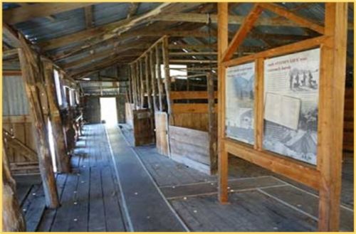 |
The Quailburn Woolshed, part of the original Benmore Station and constructed with beech pole framing. The interpretation panels describe the history of this woolshed built in the 1920’s. Sadly, due to windstorms the woolshed has suffered severe damage and awaits restoration to its former glory. |
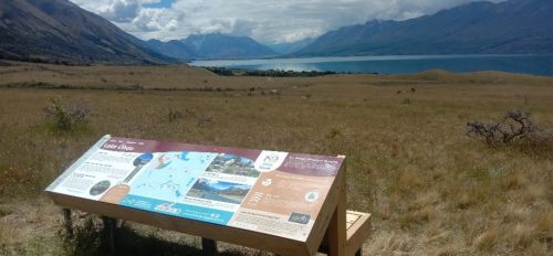 | Geopark interpretation panel on the Tarnbrae section of the trail explaining the glaciation of Lake Ohau. |
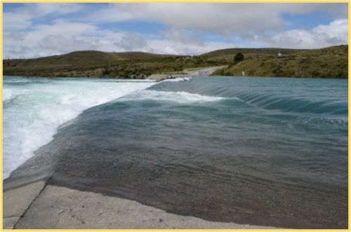 |
The Ohau weir which is one of the barriers on the trail in a major rainfall event. Plans include a proposal for a swing bridge crossing at this location. |
In total, approximately 120km (38%) currently remains on road. Further funding of $16M is needed to complete the original vision for the trail. A new Business Case was prepared in 2022 seeking funding from MBIE’s Great Ride Extension and Enhancement Fund.
In 2021 the Trail governance was restructured. A new Joint Committee was established comprising of two representatives from each of Waitaki District and Mackenzie District Councils, one representative from Department of Conservation, and a representative from each of Te Rūnanga o Moeraki, Te Rūnanga o Waihao and Te Rūnanga o Arowhenua. This group ensure the ongoing governance, development, and administration of the Trail, with the assistance of a Trail Manager. Additionally, a stakeholder reference group comprising of land owners and tourism operators was set up as an advisory think tank and represent the views of the businesses operating along the Trail.
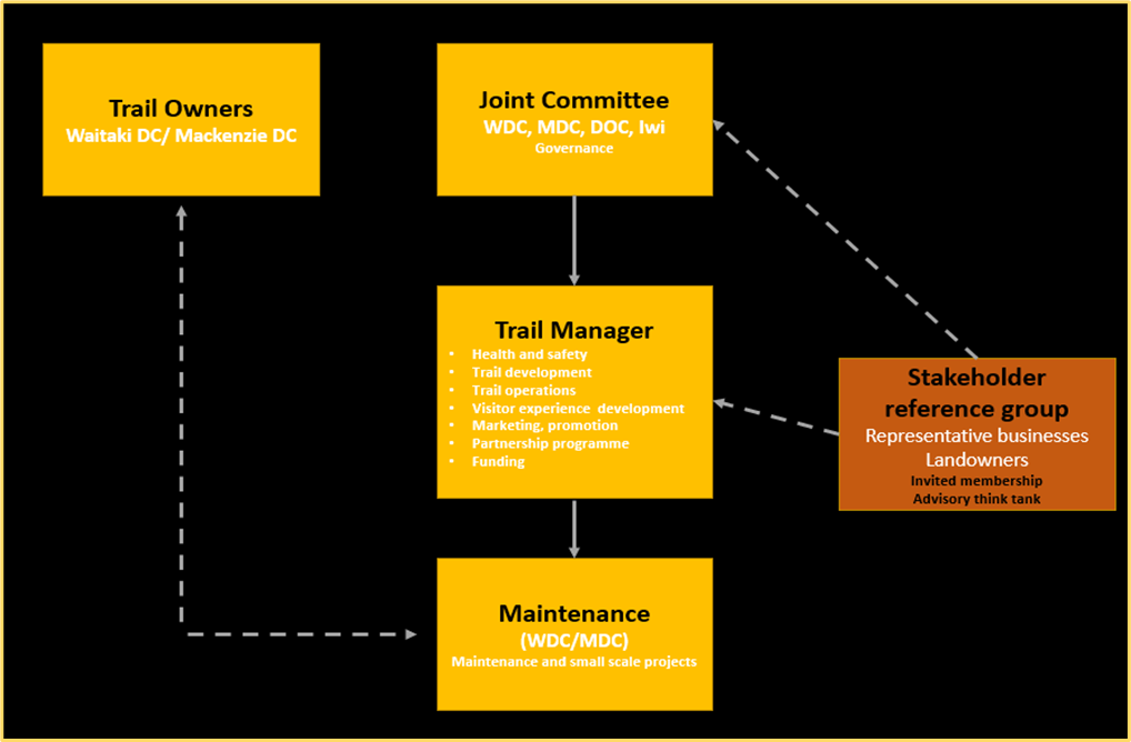 |
| Figure 3: Current Cycle Trail Governance and Management structure |
The Trail Manager took over marketing and partnership responsibilities from Tourism Waitaki and the Councils took over trail maintenance.
The trail today is a tribute to the visionaries who kicked the idea off and the many people who have contributed to the governance, planning, funding, management, building, promoting, maintaining, and providing every cyclist with an amazing experience on their trail ride over the last 10 years5.
The last word goes to Mike Neilson, first chair of the Joint Committee and the financial guru for the first 8 years of the project, who in 2016 famously said; “It was indeed an inspired decision by the Prime Minister, John Key who supported the NZ Cycle Trail concept in February 2009 and backed it with $50 million in grants. Equally the members of the first A2O Working Group were innovative in the Alps2Ocean concept and in the design of a 5 day, 300km route from Aoraki Mt Cook to the ocean at Oamaru. This was truly innovative, to offer the longest trail, downhill, usually a tail wind and giving its riders for 5 days the pleasure of the wide sky landscape of the Mackenzie Basin, Waitaki and Waiareka Valleys and very importantly giving a 5 day and night expenditure boost to the districts’ economies.”
[5] See “THE PEOPLE WHO MADE THE VISION A REALITY”.
The following organisation's have provided funding for the trail that was built between 2010 to 2021:
|
|
In addition to these major funders many partners have contributed to funding the trail both through partner fees and direct contributions.
- 2016 - Otago Sports Awards, University of Otago “Innovation in Sport Award”.
- 2017 - Lonely Planet, “Epic Bike Rides of the World”
- 2020 - Alps 2 Ocean Cycle Trail endorsed as the "Jewel in the Crown" of New Zealand’s Great Rides in Terry Stevens' book 'Wish You Were Here' and described as one of the world’s 50 great destinations. Terry Stevens (an international tourism consultant who was awarded the prestigious LUXLife title of the Best Destination Development Expert in the World in 2019) places the Alps 2 Ocean Cycle Trail amongst such iconic and well known destinations as Barcelona, Chicago and Cape Town. “While it does not constitute as a destination in the same genre as most of the examples covered in the book, the Alps 2 Ocean Cycle Trail “qualifies, however, because it exhibits all the characteristics that define a great destination: it is well-managed, innovative, transformative and is delivered through a strong collaborative effort. The vision for the project is clear: it states that A2O is to be ‘the jewel in the crown of New Zealand’s great rides that provides riders with an Alps to Ocean cycle experience that is second to none.’ It has succeeded in this goal.”
|
|
2009
- February: Prime Minister John Key announces NZ Cycle Trail concept
- February - May: Concepts developed by Mackenzie and Waitaki groups
- May: Scoping report produced for Mackenzie Cycle Trail by Mike Barnett
- May: First meeting of the Working Group with Rick Ramsay as chair
- May: 3-year national cycle way project with a budget of $50m was announced by the Government and bids into this fund were requested
- June: Inaugural meeting of the “Mackenzie to the Sea’ Working Group
- October: Mike Neilson became chair of the group
- A2O Joint Committee formalised
- December: Concept Plan to MED
2010
- A2O Project Team setup
- February: Concept Plan approval announced by Minister Jonathan Coleman, and $100,000 Feasibility Study grant approved
- March: First visit from John Dunn, (MED), to look over trail.
- May: Feasibility Study completed and submitted
- May: The first 1.3km section of the trail was opened from the historic precinct to the Penguin Colony, by the Prime Minister, John Key.
- September: Grant for $2.75M approved and contract signed with MED
- December: Chris Eden appointed Project Manager
2011
- Construction of the A2O starts with the Lake Pukaki section
- October: Jonathan Kennett, (NZCT – New Zealand Cycle Trail), visit.
- October: Lake Ohau section started
- December: Lake Pukaki section completed
- December: Tasman Point to Jollie River section completed
- December: Pukaki Flats section completed
2012
- Tim Dennis and Hamish Seaton appointed as project managers
- Aoraki section completed
- February: Lake Ohau section completed
- 2012-2014: 30kms of Kurow – Duntroon trail constructed
2013
- February: Ohau – Quailburn section completed
- February: Official opening A2O at Aoraki Mount Cook, Ohau Lodge and Omarama
- 2013-2014: Omarama -Sailors Cutting constructed
2015
- $629,000 Lottery bid for Duntroon to Oamaru
- 2015 – 2019: Four further Duntroon – Oamaru sections constructed
- Lake Takapō to Takapō B alternative route becomes official
- 2015 - 2020: Sailors Cutting – Benmore planning and construction
2016
- 2016 - 2020: Aviemore – Waitaki Village constructed
2018
- January: Awakino River – Kurow completed and open
2019
- November: NZCT Committee visits trail and meets in Omarama. Focusing on the future plans and funding required to complete the trail.
2020
- February: Aviemore – Kurow officially opened at Waitaki Village
2021
- January: Sailors Cutting - Benmore officially opened
- August: New governance structure setup with a permanent A2O Trail Manager
2022
- New Business Case developed and submitted to MBIE for $16M